
 During our recent travels we have visited the southern most part of the Continental United States, Key West. The most north western point in the Continental United States, Cape Flattery, Washington. The arctic circle, Cold Foot, Alaska. And we have visited the southern most point in the United States at Ka Lea on the Big Island in Hawaii and the Equator, Nanyuki, Kenya (admittedly both without AIROSMITH). So, why not visit the lowest elevation in North America? You would find that at the Badwater Basin in Death Valley National Park.
When we decided to visit, all of the National Park campgrounds were closed due to California Covid restrictions. The only campground we found in the park was the Fiddlers Campground at The Ranch at Furnace Creek. While the campground is a part of the Resort, it is a no hook-up site, meaning we were dry camping at a high end resort. The advantage at being at the resort was that we had access to the amenities there. Especially access to the pool.
Badwater Basin
We took the first day in the park to drive to Badwater Basin. That drive and the sites between accounted for the first days adventure.
 |
| Badwater Basin at 282 feet BELOW sea level is the lowest point in North America. Our campsite at Furnace Creek was 190 feet below sea level. |
 |
Called Badwater because mules and horses would not drink the water because of it’s high salt content. When the basin floods it deposits minerals washed down from the surrounding hills. When dry the deposits crystallize into various salts. They form incredible geometric patterns, which are covered by blown sand and dirt. These reminded us of the dust covered glaciers we saw in Alaska.


Look closely at the Sea Level sign. This photo was taken from the Badwater Basin parking lot.
Natural Bridge
Natural Bridge is a one mile round trip hike up a narrow canyon. The bridge was formed mostly by erosion over many thousands of years. Just past the bridge is a feature called a dry water fall.
Some perspective on the size of the bridge
 | | A sleight break from Covid protocol a nice couple, who were fleeing the Texas snow storm, offered to take a photo of us at the bridge. Outside and socially distanced! |
 | Dry Waterfall
Devils Golf Course
 | The reason for the description evades me, but these salt crystal deposits are massive. Some are nearly two feet high. Walk across these at your peril!
Artist’s Drive
One of the most popular drives in the park. It is a one way, nine mile drive through a multi layered and multi colored landscape of eons worth of sedimentation and erosion.
|
|
Artists Pallet Viewpoint. Each colored layer shows the character of the primary mineral deposits in that layer of sediment.
Dantes View
At above 5,000 feet above sea level it provides a sweeping view of the entire valley. You can see the snow covered Telescope Peak at 11,000 feet directly in front of you. Then, looking straight down, you see the salt flats of Badwater Basin where we were earlier that morning at 282 feet below sea level.
 | | Death Valley from Dantes View. Salt flats of Badwater Basin directly below. |
Day two and three in the park included several long drives on the characteristically rough roads leading off of the main highways. We rented a Jeep for two days making travel much easier, and giving our truck some rest. The first day was Echo Canyon, followed by Red Pass and Titus Canyon. Day two was the drive all the way out to the Racetrack Playa and the Ubehebe Crater.
Echo Canyon
 | | Zabriskie Point, off of the highway on our way to driving Echo Canyon. Here you have impressive views of the Golden Badlands of the Valley. |
 | | Zabriskie Point Badlands |
 | Echo Canyon follows a narrow canyon ending at the Inyo Mine. Driving through you see the massive power of how the water formed the canyon.
|
 | Echo Canyon
 | | Echo Canyon’s hole in the wall |
|
Inyo Mine
 | | The Inyo Mine is an abandoned gold mine. Many of the buildings and machinery still remain as part of the history of this valley. While prospectors looked for a variety of minerals, Borax was the only one that was anywhere near profitable. |
Red Pass and Titus Canyon
|
 |
| Next up was Red Pass and Titus Canyon. The canyon road itself is 27 miles long, and one way for much of it. However the drive to reach the starting point in Nevada is more than 50 miles. The road starts near the ghost town of Rhyolite. From that point it is rough gravel road over the pass and through the Canyon. |
 |
First stop, Titanothere Canyon
 | | Looking toward Death Valley from Red Pass |
|
 |
Lunch at Red Pass
 | | Red Pass Selfie |
|
 |
A stop at Klare Spring presents an opportunity to see Native American petroglyphs. Communication from an ancient time
 | Titus Canyon

The Racetrack and Uhebebe Crater
Day two in the Jeep was out to the Racetrack. The Jeep is nice because the 22 mile road from Grapevine to the Racetrack is rough and dusty. However, before you even start, you must drive the 50 miles north from Furnace Creek. Plan on a full day for the trip.
The Racetrack was named for the mysterious “sailing” rocks that travel across the floor of the Playa, leaving their tracks inscribed on the dust of the playa. The playa is almost 3 miles long, and 1.5 miles wide. The ancient lake bed is exceptionally flat loosing only 2 inches in elevation from end to end.
It wasn’t until 2014 when scientists studying the mystery of these traveling rocks was solved. They found a combination of a thin ice covering, lifted the rocks and allowed them to be moved by the wind.
|
|
 |
You first arrive at the Grandstand on the north end of the playa

 | Playa looking south
 | Sailing Rock and it’s track
 |
|
|
Returning from the Racetrack we stopped at the Ubehebe Crater. A large volcanic crater between 2,000 and 7,000 years old. It is an example of the geologic activity that helped form Death Valley. I found this view to be one of the most impressive in the Valley.
 |
The Processing Plant
 |
 |
| These wagons were pulled by mule teams from the processing plant 165 miles across the desert to the railhead in Mojave. Each train of wagons, two carrying Borax and one carrying 1200 gallons of fresh water. The entire train weighed more that 70,000 pounds. On a good day the team made 16 miles a day. |
 |
| The rear wheels were 7 feet tall |
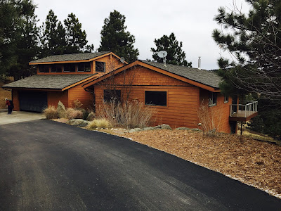
Camp Life at Fiddlers Campground
 |
| Spring fed pool |
 |
| Dinner is served! |
 |
| We were graced with the beginning of the Snow Moon while in the park |

 During our recent travels we have visited the southern most part of the Continental United States, Key West. The most north western point in the Continental United States, Cape Flattery, Washington. The arctic circle, Cold Foot, Alaska. And we have visited the southern most point in the United States at Ka Lea on the Big Island in Hawaii and the Equator, Nanyuki, Kenya (admittedly both without AIROSMITH). So, why not visit the lowest elevation in North America? You would find that at the Badwater Basin in Death Valley National Park.


Comments
Post a Comment